Jump to a question in this guide
- What changes when the water is part of the setting?
- How is a shoreline different from a parcel boundary?
- Which lake-shore processes should be distinguished?
- Why does a river-bank enquiry include movement and stability?
- How do tides, surge and waves differ at a coast?
- Why are erosion, slope stability and flooding separate questions?
- What can hazard maps and site studies tell a buyer?
- How should past events and repairs be connected?
- Why do docks and foreshore tenure need a separate record?
- What can an existing shoreline wall or other protection work prove?
- How do work permissions and occupation rights differ?
- How should alternatives be considered without assuming a seawall is the answer?
- Which access and service dependencies can lie beyond the house?
- How do insurance, borrowing and future costs fit the site enquiry?
- What does a fictional coastal purchase reveal?
- What should the waterfront handover file preserve?
- The visible shore, legal parcel and permission to occupy or alter a waterfront feature are different enquiries.
- Flooding, erosion and slope stability can affect the home, access and services differently; retain each study’s site, dates, assumptions and limits.
- A dock tenure, shore-work authorization or completed wall repair does not establish the condition or protection of the whole property.
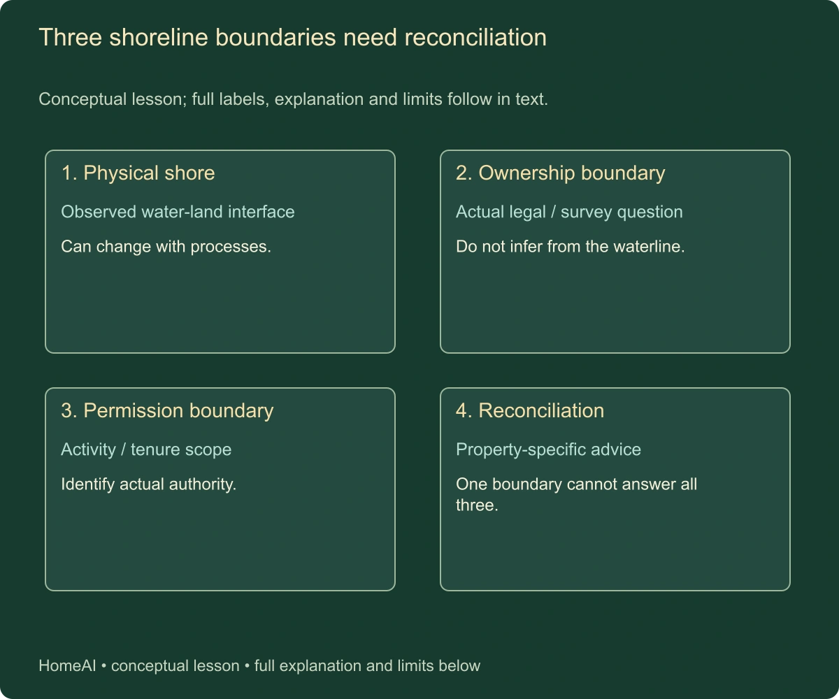
Physical, ownership and regulatory descriptions perform different jobs.
About this illustration
No actual ownership, public access, setback or work permission. This is a conceptual teaching model, not an assessment of your home.
9 picture lessons appear beside the questions in this guide. Use them to understand the explanation, then consider what it means for your home.
What changes when the water is part of the setting?
A waterfront home offers a relationship with a lake, river or coast, but the household is buying more than a view. The building, land, shore, access route and services can each have different physical exposures and legal arrangements. A dock or shoreline wall can add another asset and responsibility. Begin by identifying the actual parts rather than treating waterfront as one complete property description.
Ask where the home sits relative to the water, what land and rights are included, how people reach it and which services support it. Those questions remain relevant whether the property is a permanent residence or another permitted use. A photograph showing calm water and a green lawn provides a momentary view, not evidence of all seasons, legal boundaries or future conditions.
This guide follows the shoreline-property transaction. The flood-risk/insurance guide addresses hazard evidence and coverage as separate enquiries, and the title-and-survey guide addresses wider record reconciliation. Here the added scope is the changing shore itself, erosion and slope questions, docks and works, tenure, permissions and off-lot dependencies. It is not a design manual for shoreline protection.
Named sources retain their geography and dates: Nova Scotia's February 2024 coastal-property guide, Environment and Climate Change Canada's June 5, 2026 coastal-alert page, Ontario's September 25, 2026 shore-work page and current complete Alberta, TRCA and BC Assessment bodies. No published sea-level number, erosion rate, setback, permit exemption or insurance entitlement is applied to a reader's site.
A household needs both a usable home and a clear understanding of the setting. Physical exposure, property rights, technical condition and authority requirements interact without becoming one answer. An approved dock cannot prove a stable bank, and a house above an observed water level cannot prove every road, service or future use is unaffected.
How is a shoreline different from a parcel boundary?
The visible meeting of land and water is a physical feature influenced by the setting and conditions. A legal parcel boundary comes from the applicable law, survey and instruments. A regulatory shore-land definition serves another purpose. These descriptions can refer to related locations without being interchangeable. Ask the survey and legal professionals to identify the actual boundaries and rights relevant to the property.
Alberta's current rivers-and-streams page explains that rivers can change through erosion and sediment deposition and distinguishes the moving natural feature from ownership boundaries. That is a named provincial explanation, not a universal boundary rule for every Canadian coast or watercourse. The actual law and records determine the answer at the reader's site.
Ontario's current shore-work page defines shore lands for its regulatory scope and distinguishes the land it manages and other situations. The guide does not use that definition to draw a property line or decide ownership. A high-water-related term in a permit enquiry should not silently become a surveyed title boundary or a public-access conclusion.
Ask whether the advertised frontage, garden, steps, beach area and dock relate to the actual parcel, separate tenure, public land or another right. A fence, retaining wall or mown lawn does not resolve that legal enquiry. Nor does a simple map pin establish the limits of a water lot or shoreline occupation.
Keep physical and legal discrepancies visible. If an old plan, current shoreline and seller description differ, the appropriate professionals must reconcile them. Do not move markers, extend landscaping, enter neighbouring property or claim exclusive use of a beach based on the general illustration in this guide. Its terrain is conceptual and contains no legal boundary.
Three shoreline boundaries need reconciliation
Physical, ownership and regulatory descriptions perform different jobs.
Numbers identify the parts explained below.
- Physical shore
Observed water-land interface. Can change with processes.
- Ownership boundary
Actual legal / survey question. Do not infer from the waterline.
- Permission boundary
Activity / tenure scope. Identify actual authority.
What does this illustration leave out?
No actual ownership, public access, setback or work permission. This illustration explains an idea. It is not an installation guide.
Which actual documents and qualified advice resolve the distinction?
Explore this with HomeAI ↗Opens an editable question. Nothing is sent until you choose to send it.Three shoreline boundaries need reconciliation
Conceptual lesson; full labels, explanation and limits follow in text.
- Physical shore
- Observed water-land interface. Can change with processes.
- Ownership boundary
- Actual legal / survey question. Do not infer from the waterline.
- Permission boundary
- Activity / tenure scope. Identify actual authority.
- Reconciliation
- Property-specific advice. One boundary cannot answer all three.
Physical, ownership and regulatory descriptions perform different jobs.
What remains unknown: No actual ownership, public access, setback or work permission.
A useful question: Which actual documents and qualified advice resolve the distinction?
Which lake-shore processes should be distinguished?
A lake shore can experience changing water levels, waves, wind-driven effects and other conditions identified by the actual assessment. Those processes can affect different parts of the property. A sheltered-looking viewing day does not establish exposure during another season or event. Ask the relevant specialists which processes matter at this particular lake and reach of shore.
Environment and Climate Change Canada's current coastal-flooding explanation includes the Great Lakes and describes the interaction of water levels and wave action. Its national explanation does not supply a design level for a particular lot. The household needs the relevant local studies, mapping and professional interpretation rather than importing a number from another lake.
Wave exposure and shoreline material are different inputs to an enquiry. A vegetated bank, sandy beach, rock edge and built structure need not respond in the same way. Nova Scotia's coastal guide illustrates varied shoreline types, but its ocean examples are not a lake-specific design prescription. The actual professional must assess the site's material, geometry and exposure.
Ask whether seasonal docks, shoreline stairs and other features are available and permitted under the actual conditions and arrangements. A structure being present in one photograph does not establish year-round use, safe access or transferability. The buyer needs the relevant tenure, operating and condition records for the specific feature.
Keep lake-level observations separate from a flood or erosion assessment. A seller may accurately remember a previous high-water mark without knowing the technical reference or wider range of conditions. Retain the recollection as reported history and obtain the applicable evidence. This guide supplies no instruction to mark a safe building elevation from a casual water observation.
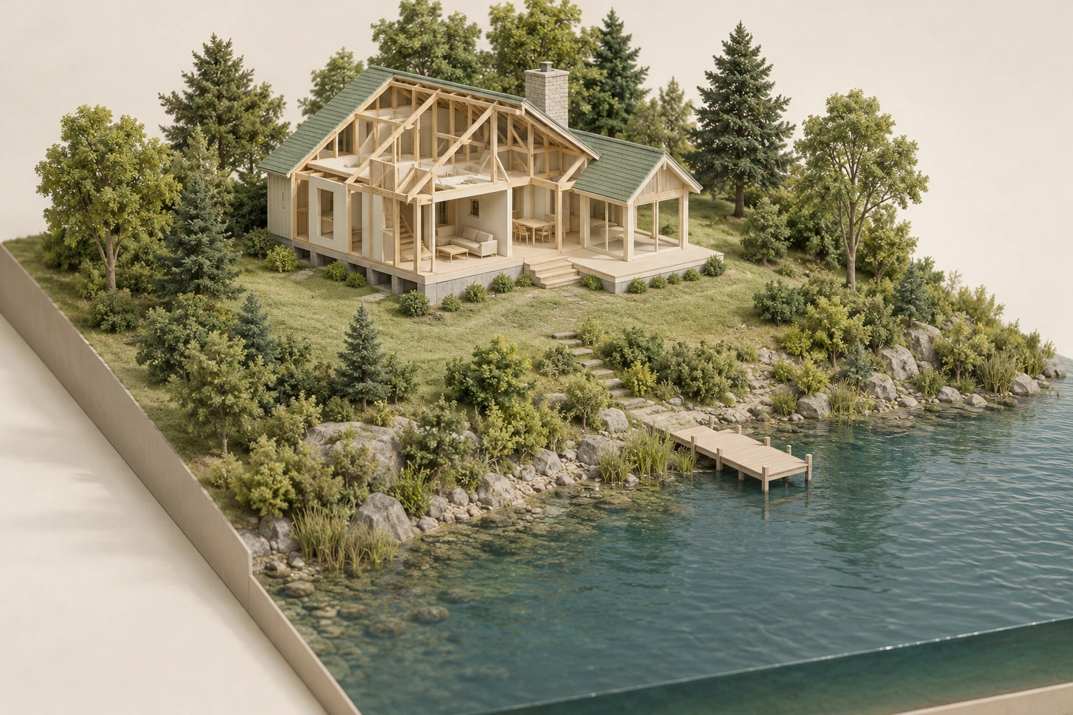
What does a lake view leave unresolved about parcel, access and works
Home, vegetated lake bank, path and small dock in a terrain model; no parcel boundary, safe setback or water-access right.
Numbers identify the parts explained below.
- Visible context
Home, vegetated lake bank, path and small dock in a terrain model; no parcel boundary, safe setback or water-access right.
- Limit
Conceptual generated context. No actual property, installed design, topology, measured performance, approval, ownership or responsibility established.
What does this illustration leave out?
Conceptual generated context. No actual property, installed design, topology, measured performance, approval, ownership or responsibility established. This illustration explains an idea. It is not an installation guide.
What does a lake view leave unresolved about parcel, access and works?
Explore this with HomeAI ↗Opens an editable question. Nothing is sent until you choose to send it.What does a lake view leave unresolved about parcel, access and works
Home, vegetated lake bank, path and small dock in a terrain model; no parcel boundary, safe setback or water-access right.
What remains unknown: Conceptual generated context. No actual property, installed design, topology, measured performance, approval, ownership or responsibility established.
A useful question: What does a lake view leave unresolved about parcel, access and works?
Why does a river-bank enquiry include movement and stability?
A river carries water and sediment through a channel. Flow can remove bank material, while sediment can accumulate elsewhere. Alberta's current guidance describes erosion and accretion as part of a dynamic landscape and notes that flooding can bring sudden course changes. The practical lesson is to assess the actual reach rather than assume the channel will always occupy its present position.
TRCA's complete current erosion explanation distinguishes direct removal by flowing water from bank or slope failure. It also discusses surface runoff affecting exposed slopes. These are different mechanisms that a relevant specialist may need to consider. A crack, bare patch or steep-looking bank in a photograph does not establish which mechanism operates or its significance at a property.
Ask what the assessment covers: the channel, bank, valley slope, nearby structures and relevant drainage, as applicable. A flood map and a slope-stability assessment can have different purposes and limits. The fact that a house is above a mapped water level does not independently settle the stability of the ground or the condition of a crossing.
Reported changes need dates and locations. A photograph after one event may show fresh deposition or an eroded area without describing the longer history. Ask the professional how the available evidence supports the conclusion and whether monitoring or further investigation is proposed. The household should not calculate a future bank position from two informal photos.
Stay on permitted safe routes and respect barriers and current warnings. Do not approach an undermined bank, descend a restricted slope or enter a watercourse to collect evidence. Qualified professionals determine safe investigation and the appropriate method. The buyer's task is to obtain and understand the actual findings, not imitate a geotechnical or river-engineering assessment.
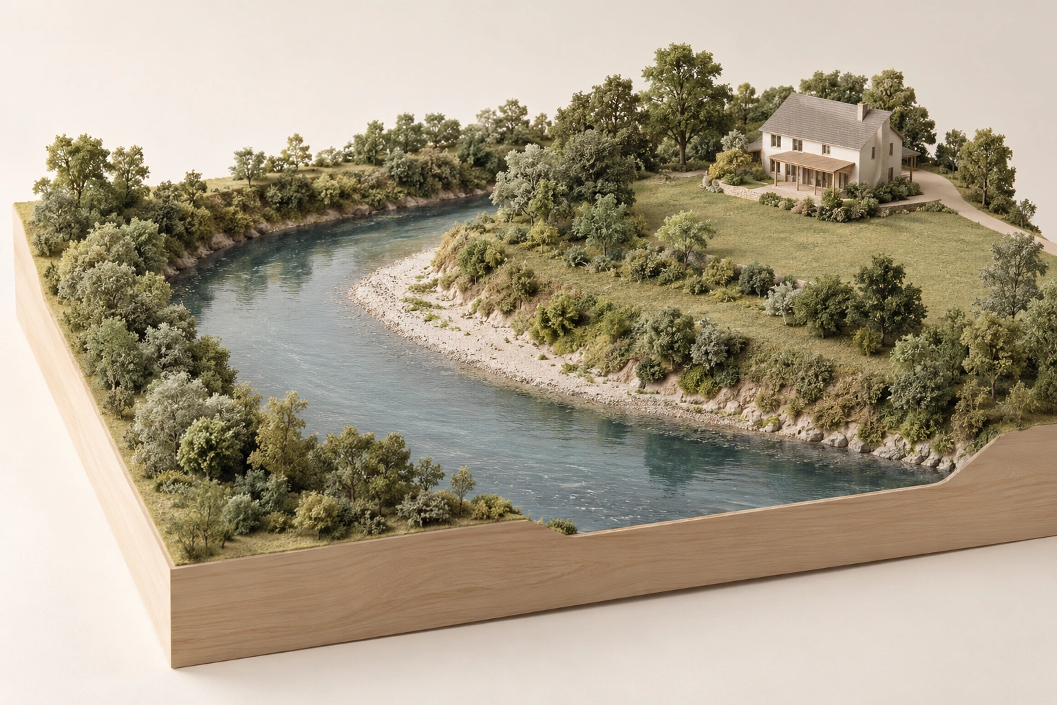
Which river processes and site-specific evidence affect the enquiry
River bend, vegetated banks and home on higher land; no waterflow path, flood level or ownership boundary.
Numbers identify the parts explained below.
- Visible context
River bend, vegetated banks and home on higher land; no waterflow path, flood level or ownership boundary.
- Limit
Conceptual generated context. No actual property, installed design, topology, measured performance, approval, ownership or responsibility established.
What does this illustration leave out?
Conceptual generated context. No actual property, installed design, topology, measured performance, approval, ownership or responsibility established. This illustration explains an idea. It is not an installation guide.
Which river processes and site-specific evidence affect the enquiry?
Explore this with HomeAI ↗Opens an editable question. Nothing is sent until you choose to send it.Which river processes and site-specific evidence affect the enquiry
River bend, vegetated banks and home on higher land; no waterflow path, flood level or ownership boundary.
What remains unknown: Conceptual generated context. No actual property, installed design, topology, measured performance, approval, ownership or responsibility established.
A useful question: Which river processes and site-specific evidence affect the enquiry?
How do tides, surge and waves differ at a coast?
Tides describe regular changes in sea level under their natural influences. Storm-related surge can change water levels, while waves can drive additional water and forces toward the shore. Environment and Climate Change Canada's current explanation distinguishes these contributors and explains that their combination can worsen coastal flooding. No one viewing-day waterline describes all of them.
The national source also explains that terminology and alert arrangements differ by region. The household should check the current local alert and emergency-information process when needed. This guide supplies no permanent contact directory, event forecast or assurance that absence of a particular label means absence of a hazard.
A coast's local configuration matters. Exposure, elevation, nearshore features and shoreline material can differ substantially between nearby properties. Nova Scotia's February 2024 guide emphasizes site-specific geography and professional advice. Its illustrative projections and coastal examples are not a forecast of the reader's property or a safe elevation for construction.
Ask which conditions the actual study addresses and which time horizon and assumptions it uses. A historical event, current design enquiry and future scenario answer different questions. The professional should explain how they relate to the household's intended use without turning a scenario into a guaranteed future date or level.
Follow current safety instructions during coastal warnings. Do not visit the water's edge during a hazardous event to see whether a listing's description was accurate. A transaction enquiry can use authorized records and professional assessment. The attractive proximity that motivates a purchase should not become a reason to approach an unstable or overtopped edge.
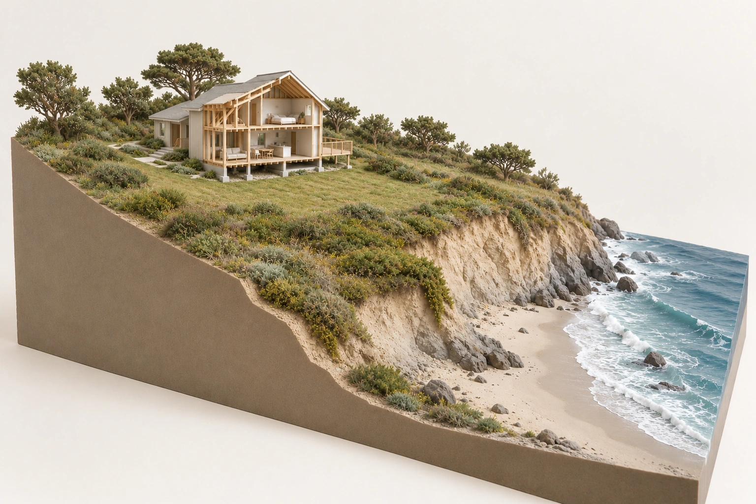
How are bluff stability, erosion and flooding different questions
broader coastal terrain with home farther inland and vegetation between it and bluff; no safe-setback, geological or stability finding.
Numbers identify the parts explained below.
- Visible context
broader coastal terrain with home farther inland and vegetation between it and bluff; no safe-setback, geological or stability finding.
- Limit
Conceptual generated context. No actual property, installed design, topology, measured performance, approval, ownership or responsibility established.
What does this illustration leave out?
Conceptual generated context. No actual property, installed design, topology, measured performance, approval, ownership or responsibility established. This illustration explains an idea. It is not an installation guide.
How are bluff stability, erosion and flooding different questions?
Explore this with HomeAI ↗Opens an editable question. Nothing is sent until you choose to send it.How are bluff stability, erosion and flooding different questions
broader coastal terrain with home farther inland and vegetation between it and bluff; no safe-setback, geological or stability finding.
What remains unknown: Conceptual generated context. No actual property, installed design, topology, measured performance, approval, ownership or responsibility established.
A useful question: How are bluff stability, erosion and flooding different questions?
Why are erosion, slope stability and flooding separate questions?
Flooding concerns water reaching areas or assets under relevant conditions. Erosion concerns movement or loss of material. Slope stability concerns the ground's ability to remain stable under the actual conditions. They can interact, but evidence about one does not automatically resolve the others. Ask the relevant professional to state which hazards the assessment actually addresses.
Nova Scotia's guide explains that erosion can bring the water closer to structures or affect access, while TRCA describes runoff and bank processes that can involve instability. These explanations support a combined site enquiry. They do not establish that any particular cliff is unstable, that a vegetated slope is safe or that one protection structure removes every hazard.
A home can be located above ordinary water yet still depend on a slope, road or utility route requiring separate assessment. A low-lying property can have different flood exposure without a steep bank. Avoid using one visible feature, such as height above the beach, as a complete risk ranking. The actual terrain and evidence must guide the conclusion.
Ask for the report's boundaries, methods, reference dates and limitations. Did it assess the whole site or a defined proposed work? Were concealed conditions, neighbouring reaches or particular events outside its scope? A report prepared to design one repair should not silently become a guarantee of long-term property safety or unrestricted future development.
The generic bluff image shows a home within broader inland terrain and a coastal edge. It establishes no safe setback, geological layers or stability finding. Its purpose is to make the different components recognizable before the reader asks about actual evidence. The composition is still an illustration, not a recommendation for where to build.
Water, material and stability differ
Parallel mechanisms can interact; a flood finding is not automatically an erosion or stability finding.
Numbers identify the parts explained below.
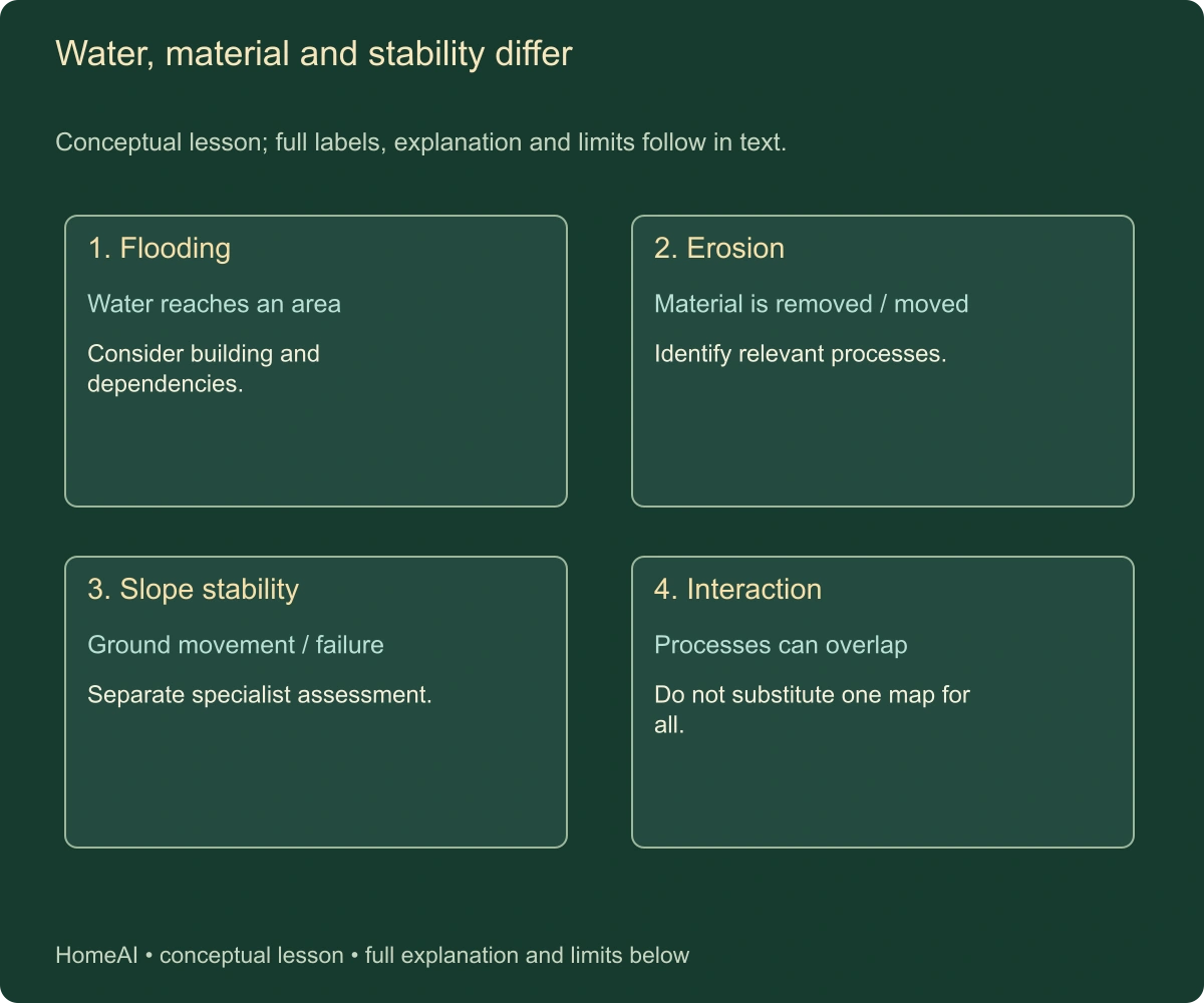
- Flooding
Water reaches an area. Consider building and dependencies.
- Erosion
Material is removed / moved. Identify relevant processes.
- Slope stability
Ground movement / failure. Separate specialist assessment.
What does this illustration leave out?
No actual flood level, erosion rate, slope diagnosis or safe distance. This illustration explains an idea. It is not an installation guide.
Which actual documents and qualified advice resolve the distinction?
Explore this with HomeAI ↗Opens an editable question. Nothing is sent until you choose to send it.Water, material and stability differ
Conceptual lesson; full labels, explanation and limits follow in text.
- Flooding
- Water reaches an area. Consider building and dependencies.
- Erosion
- Material is removed / moved. Identify relevant processes.
- Slope stability
- Ground movement / failure. Separate specialist assessment.
- Interaction
- Processes can overlap. Do not substitute one map for all.
Parallel mechanisms can interact; a flood finding is not automatically an erosion or stability finding.
What remains unknown: No actual flood level, erosion rate, slope diagnosis or safe distance.
A useful question: Which actual documents and qualified advice resolve the distinction?
What can hazard maps and site studies tell a buyer?
Maps can help identify an area or scenario needing further enquiry. A site-specific study can address a defined property question under recorded assumptions and methods. Neither should be interpreted without its date, scale, purpose and limits. Ask the responsible authority and appropriate professional how the available information applies to the actual property.
A coloured map boundary can be a useful screening result without being a precise survey of every doorstep, bank or service component. The household needs to know what the map depicts and what it omits. This guide has not mapped the reader's property and supplies no safe-area certification or claim that a location outside a displayed zone is hazard-free.
Historical, present and future-scenario information also differ. A future scenario may depend on stated assumptions, while a historical record describes an observed event. Ask how the professional uses both and what uncertainties remain. Do not compare two studies as though they predict the same period and conditions when their reference dates and purposes differ.
The authority's planning or permit enquiry can be separate from an insurer's or lender's assessment. A study accepted for one purpose is not automatically accepted for every other one. Give each provider accurate property information and ask what evidence it requires. Keep their actual response and conditions distinct from the general hazard map.
If the relevant study is missing or outdated for the intended question, record that as an evidence hold. The next step is to obtain the appropriate current advice or assessment, not fill the gap with a generic erosion rate. A clear limit is more useful than a detailed household forecast based on information never intended for that property.
How should past events and repairs be connected?
Before treating an event record as evidence about the whole property, separate the source, pathway and affected asset. A storm or high-water episode describes a possible source; the route by which water or material reaches an area is another question; the house, road, dock or service is the asset whose consequence matters. This is an organizing method for the enquiry, not a site hazard model or a claim that one process caused the reported damage.
A house can remain visibly unaffected while another dependency is interrupted. Conversely, damage to a dock does not by itself establish damage to the house. Ask which locations the available account actually covers and what was observed afterward. This prevents both an event label and an apparently intact building from replacing the whole-property assessment.
Ask for the known history of flooding, erosion, shoreline changes and relevant works through the authorized transaction process. Retain dates, locations and the source of each statement. A resident recollection, dated photograph, technical report, insurance record and contractor invoice have different evidentiary roles. Their value increases when they can be connected to the same actual event and component.
Absence of a supplied history is not proof that no event occurred. Conversely, a reported past event does not by itself establish the present condition or future outcome. The legal and technical advisers must explain the appropriate enquiries for the transaction. This guide gives no universal disclosure rule or conclusion about a seller's legal responsibility.
A repair record should identify what it addressed and what remained outside its scope. Work on a dock, bank, drain or interior room may respond to different consequences. A paid invoice shows a transaction; the professional and completion documents address the actual work and assessed result. Do not combine them into a claim that the entire waterfront property was made safe.
Ask whether later events or alterations changed the original assumptions. A shore structure may have been repaired, a neighbouring reach may have changed or the household's intended use may differ from the earlier study. The appropriate professional should determine whether further assessment is needed. A ten-year-old letter should retain its actual date rather than be presented as a fresh property conclusion.
Keep useful context without overstating precision. A photograph can show a location and condition when taken but may not supply a measured water level or surveyed bank position. The professional can explain how it contributes to the enquiry. The buyer should not turn an ordinary holiday image into a numerical hazard assessment.
Why do docks and foreshore tenure need a separate record?
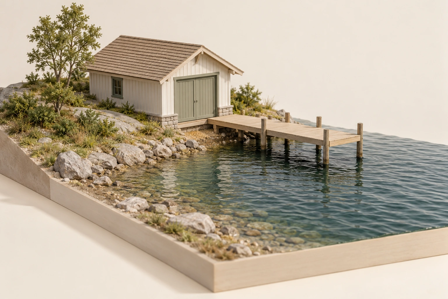
A waterfront parcel and a structure extending over water can involve different land interests, permissions and records. Ask who owns or occupies the relevant area, what authorizes the dock or other structure, and how the arrangement is dealt with on a sale. The structure's physical attachment to the shore does not settle these questions.
BC Assessment's complete current purchaser guidance explains a named provincial distinction: a land-title ownership update does not automatically update foreshore tenure records for private moorage. The guide uses that as a reason to identify the separate transaction task. It does not declare the actual dock authorized, determine its tenure type or apply BC's assessment arrangements elsewhere.
Ask the legal professional and responsible authority for the actual instrument, site reference, term, conditions and any required assignment or record update. If a general-permission arrangement rather than an individual tenure is asserted, obtain the appropriate current explanation. Do not choose the most favourable category from a general website and declare it applies to the property.
Condition is another enquiry. A valid permission does not demonstrate the dock's structural or operating suitability. A repair quotation does not create tenure or navigation approval. The qualified assessor and authority must explain their respective scopes. The household should not enter a damaged or restricted structure during a viewing to test it.
Also keep access and use rights distinct. A view of the water, a neighbouring path and an existing dock do not establish exclusive beach use, mooring rights or permission to cross another parcel. This guide supplies no public-access legal rule. The actual documents, law and current advice must establish what the household may rely on.
Which separate land, foreshore and structure records are needed
Small closed boathouse, shoreline and dock; no high/low-water boundary, tenure or authorization proof.
Numbers identify the parts explained below.
- Visible context
Small closed boathouse, shoreline and dock; no high/low-water boundary, tenure or authorization proof.
- Limit
Conceptual generated context. No actual property, installed design, topology, measured performance, approval, ownership or responsibility established.
What does this illustration leave out?
Conceptual generated context. No actual property, installed design, topology, measured performance, approval, ownership or responsibility established. This illustration explains an idea. It is not an installation guide.
Which separate land, foreshore and structure records are needed?
Explore this with HomeAI ↗Opens an editable question. Nothing is sent until you choose to send it.Which separate land, foreshore and structure records are needed
Small closed boathouse, shoreline and dock; no high/low-water boundary, tenure or authorization proof.
What remains unknown: Conceptual generated context. No actual property, installed design, topology, measured performance, approval, ownership or responsibility established.
A useful question: Which separate land, foreshore and structure records are needed?
What can an existing shoreline wall or other protection work prove?
Read any assessment of protection work in relation to the feature's stated purpose and the land around it. A report about a visible wall face may not address its foundation, adjacent shore or the bank behind it. A report about a particular repaired section may not cover the full shoreline. Ask the professional to explain the relevant extent rather than assuming every photograph and invoice describes the same asset boundary.
Keep the evidence of construction separate from evidence of current function. A dated work record can identify what was installed under the described project, while a later condition assessment addresses what can be established now. Neither should become a guarantee of indefinite protection. Where there is no adequate record, the appropriate next enquiry may be specialist investigation rather than a guessed repair allowance or an immediate recommendation to replace the structure.
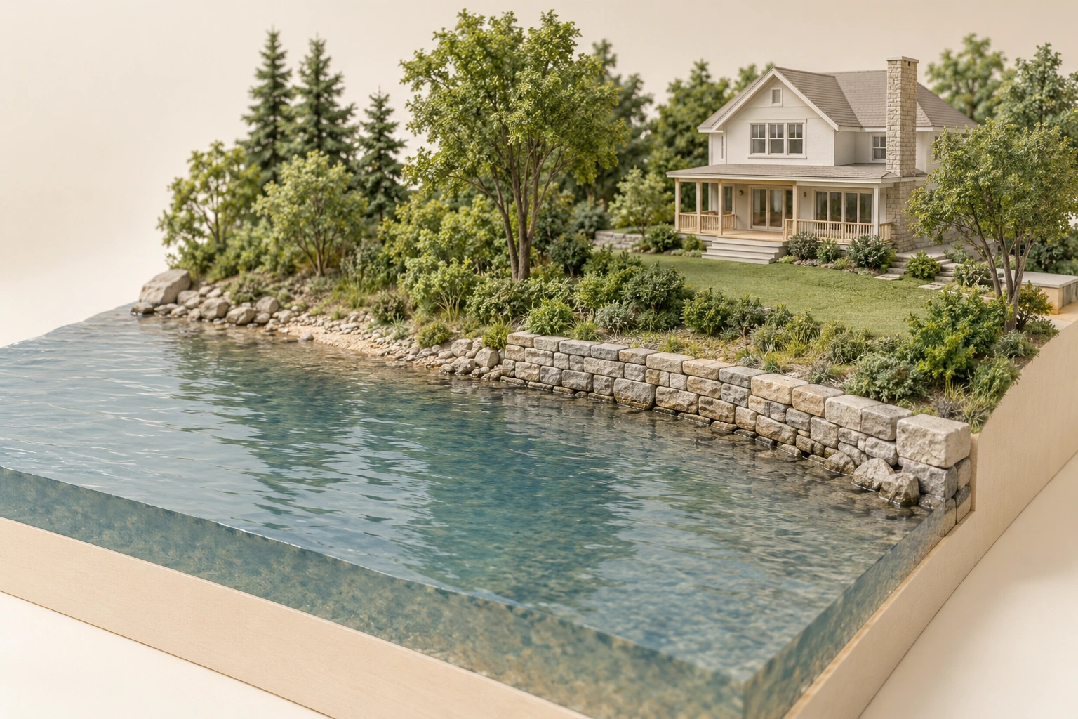
An existing structure shows that something was built. It does not establish its design basis, permissions, ownership, condition, remaining responsibilities or effectiveness under every event. Ask for the relevant assessment, drawings, authorizations, construction changes and completion information. A tidy stone edge in a photograph is not a performance test.
Different works can serve different purposes. A wall may retain land, a shore structure may address a defined erosion concern, and drainage may manage water from the site. The relevant professional must identify the actual functions and interactions. A single marketing phrase such as shoreline protected can hide the distinction between those jobs.
Nova Scotia's February 2024 guide discusses drawbacks and maintenance of hardened shorelines and the need to consider natural processes and alternatives. That does not establish that every existing wall is unsuitable or that a particular nature-based option will work. The site-specific design and authority enquiry remain necessary before selecting or altering a protection measure.
Ask how the assessment considers neighbouring reaches, water movement and environmental effects where relevant. A project confined to one frontage can still have relationships beyond a property boundary. The guide gives no rock size, wall height, foundation detail or method to redirect waves. Such work requires the appropriate authorized professionals and approvals.
A current maintenance record should identify who monitors and repairs the actual asset and how a concern is reported. If a sale transfers responsibility, ask the legal professional to explain it. An old permit, a neighbouring owner's informal offer or a contractor's proposed service plan is not automatically the complete continuing arrangement.
What does an existing shore structure fail to prove about permission and performance
Short stone shoreline edge next to natural vegetated bank, with house inland; no design suitability, permission or performance proof.
Numbers identify the parts explained below.
- Visible context
Short stone shoreline edge next to natural vegetated bank, with house inland; no design suitability, permission or performance proof.
- Limit
Conceptual generated context. No actual property, installed design, topology, measured performance, approval, ownership or responsibility established.
What does this illustration leave out?
Conceptual generated context. No actual property, installed design, topology, measured performance, approval, ownership or responsibility established. This illustration explains an idea. It is not an installation guide.
What does an existing shore structure fail to prove about permission and performance?
Explore this with HomeAI ↗Opens an editable question. Nothing is sent until you choose to send it.What does an existing shore structure fail to prove about permission and performance
Short stone shoreline edge next to natural vegetated bank, with house inland; no design suitability, permission or performance proof.
What remains unknown: Conceptual generated context. No actual property, installed design, topology, measured performance, approval, ownership or responsibility established.
A useful question: What does an existing shore structure fail to prove about permission and performance?
How do work permissions and occupation rights differ?
A right to occupy land or maintain a structure and an authorization to carry out particular work can be different instruments. Municipal planning, conservation, provincial land, federal fisheries or navigation processes can also have distinct purposes. Ask the actual authorities and legal professional which requirements apply to the defined location and proposal.
Ontario's current Crown-land/shore-work page expressly explains that another authority's permit does not replace a ministry work permit when one is required. It also identifies separate occupational-authority and other-approval questions. This is a named Ontario example of parallel requirements, not a complete Canadian permit list or a finding that the reader needs a particular permit.
Define the work accurately before seeking the answer. Maintaining an existing feature, enlarging it, changing its location, adding fill, disturbing vegetation and constructing a new structure can raise different questions. The actual authority must determine the applicable process. The guide adopts none of the source's numerical size thresholds or conditional exemptions as permission to act.
Keep a submission, decision and completed work separate. An application acknowledges a proposed project; an authorization concerns its actual scope and conditions; construction and relevant completion records address what was performed. A future buyer needs that relationship, particularly if the visible structure differs from the old drawing or the project changed midway.
Do not move rocks, excavate, fill, remove vegetation, deepen water or repair a shore structure based on a general guide. Arrange the actual professional and authority process. A household's wish to improve access or appearance does not establish technical suitability or permission to change the land-water interface.
A dock or wall needs three enquiries
Tenure, permission, condition and future duties remain distinct even for one visible asset.
Numbers identify the parts explained below.
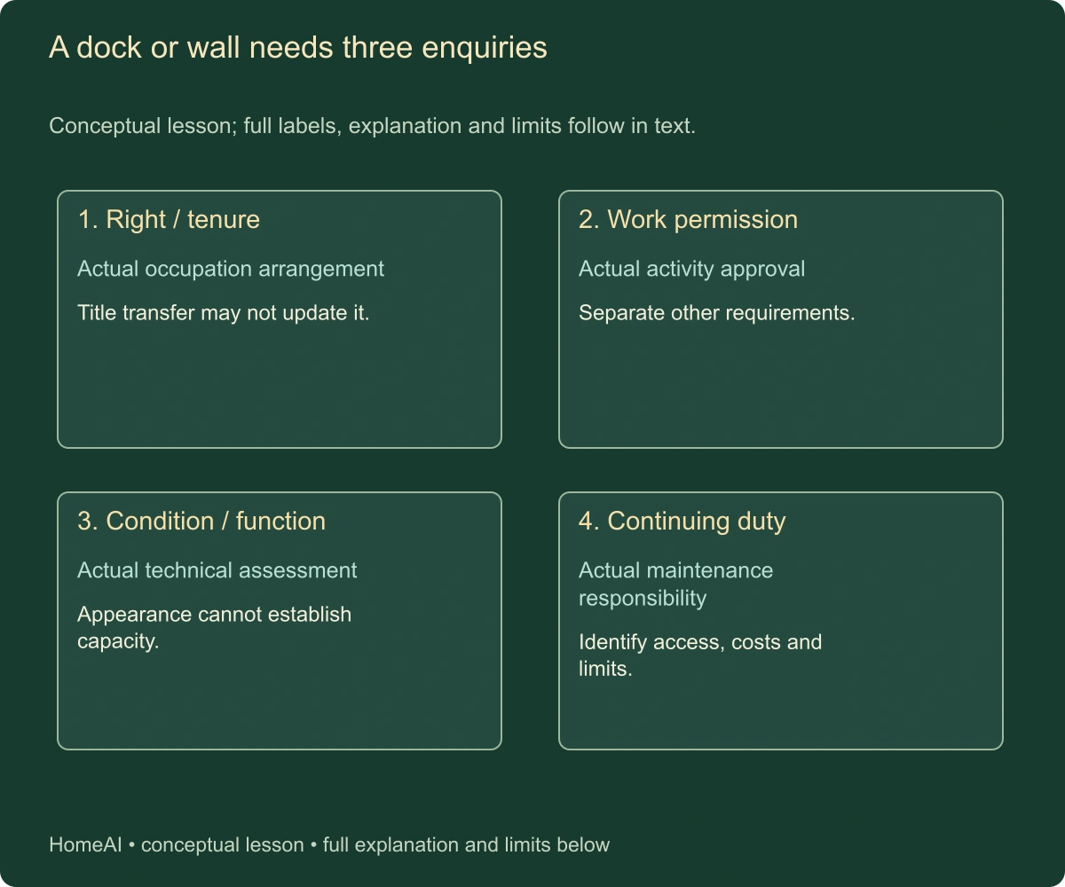
- Right / tenure
Actual occupation arrangement. Title transfer may not update it.
- Work permission
Actual activity approval. Separate other requirements.
- Condition / function
Actual technical assessment. Appearance cannot establish capacity.
What does this illustration leave out?
No current permit, valid tenure, design or service-life promise. This illustration explains an idea. It is not an installation guide.
Which actual documents and qualified advice resolve the distinction?
Explore this with HomeAI ↗Opens an editable question. Nothing is sent until you choose to send it.A dock or wall needs three enquiries
Conceptual lesson; full labels, explanation and limits follow in text.
- Right / tenure
- Actual occupation arrangement. Title transfer may not update it.
- Work permission
- Actual activity approval. Separate other requirements.
- Condition / function
- Actual technical assessment. Appearance cannot establish capacity.
- Continuing duty
- Actual maintenance responsibility. Identify access, costs and limits.
Tenure, permission, condition and future duties remain distinct even for one visible asset.
What remains unknown: No current permit, valid tenure, design or service-life promise.
A useful question: Which actual documents and qualified advice resolve the distinction?
How should alternatives be considered without assuming a seawall is the answer?
Compare alternatives against the household's actual objective. Protecting a particular building, preserving a lawn edge, maintaining access and retaining a dock are different objectives and may involve different effects or permissions. Ask the specialist to explain what an option addresses and what it leaves exposed. A measure that helps one asset may not resolve the household's broader dependency on the site.
Also ask how an option changes future decisions. A substantial intervention can create maintenance, monitoring, access and renewal obligations. A decision to avoid or relocate an exposed use can change how the household uses the property. These are not reasons to select one universal solution; they are consequences to understand alongside feasibility, effects and residual risk. Generic cost rankings cannot substitute for actual proposals and site advice.
Start with the actual hazard, affected asset and household purpose. A proposal to protect a house, maintain a path, improve access or address a drainage concern can have different feasible alternatives. The relevant professionals should define the problem before comparing options. A visually dramatic structure is not automatically the most suitable or complete response.
Nova Scotia's guide distinguishes avoiding harm from reducing impacts and discusses options that work with natural processes. Those are broad decision categories, not household construction instructions. Actual proposals may involve changed use, relocation, accommodation, conservation of natural features or engineered work, depending on the site and current permissions.
Compare options using the same scope and time horizon. Ask what each option aims to achieve, what it leaves exposed, what investigation and approvals it requires, how it affects access and services and what continuing maintenance follows. A quoted installation amount alone cannot represent the full decision where associated work and future obligations differ.
No option should be described as floodproofing the property against every possible event. The appropriate professional must state the design basis and limits. The household also needs to understand residual exposure and any emergency or access plan under the actual arrangement. This guide supplies no probability of failure or guaranteed protected period.
If an alternative is not feasible under the actual rights, site or approvals, record that rather than assigning a speculative extra cost. Some constraints can change the household's intended use or purchase decision. The legal, technical and personal suitability enquiries should remain visible instead of being compressed into one invented cost-benefit score.
Which access and service dependencies can lie beyond the house?
A waterfront home may depend on a road, bridge, shared lane, landing or another access arrangement. Ask how the household and required services reach it under the intended use and relevant conditions. A house above the water does not establish that its only access route remains usable during a flood or another event.
Identify off-lot rights and responsibilities through the actual agreements and legal advice. The private-roads/shared-services guide provides wider detail, but the shoreline setting adds exposure questions for crossings, slopes and routes. A map showing a line to the home does not demonstrate a maintained year-round service or a right to cross every segment.
Water and wastewater also need their own records. If the property uses private or shared systems, obtain the relevant professional and authority information rather than infer adequacy from proximity to a lake. Nova Scotia's guide discusses saltwater intrusion as a location-specific coastal groundwater concern. That is a reason for the appropriate water and hydrogeological enquiry, not a diagnosis from taste or a guarantee that an inland-looking well is unaffected.
Ask which services or equipment were included in any earlier hazard or repair assessment. A shore-wall project may exclude the water source, septic arrangement, electrical route or road. The household needs to know the limits before assuming the wider property received one comprehensive review. Keep technical and account information tied to identified actual components.
Retain the current reporting and emergency-information arrangement. Follow official instructions during hazardous conditions and do not drive through restricted routes or approach damaged service infrastructure to gather evidence. A transaction decision should use the responsible providers and professionals, with unresolved service and access questions explicitly recorded.
Which off-lot access and service dependencies accompany the waterfront setting
Waterfront home, inland access lane and outbuilding with simple small enclosure; no component identity, service route, ownership or adequacy established.
Numbers identify the parts explained below.
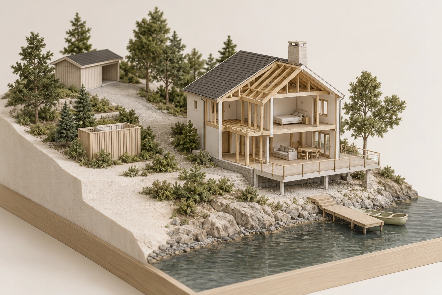
- Visible context
Waterfront home, inland access lane and outbuilding with simple small enclosure; no component identity, service route, ownership or adequacy established.
- Limit
Conceptual generated context. No actual property, installed design, topology, measured performance, approval, ownership or responsibility established.
What does this illustration leave out?
Conceptual generated context. No actual property, installed design, topology, measured performance, approval, ownership or responsibility established. This illustration explains an idea. It is not an installation guide.
Which off-lot access and service dependencies accompany the waterfront setting?
Explore this with HomeAI ↗Opens an editable question. Nothing is sent until you choose to send it.Which off-lot access and service dependencies accompany the waterfront setting
Waterfront home, inland access lane and outbuilding with simple small enclosure; no component identity, service route, ownership or adequacy established.
What remains unknown: Conceptual generated context. No actual property, installed design, topology, measured performance, approval, ownership or responsibility established.
A useful question: Which off-lot access and service dependencies accompany the waterfront setting?
How do insurance, borrowing and future costs fit the site enquiry?
Use a common time frame when comparing the available information. A present condition report, a long-term hazard study, a short insurance term and the household's intended ownership period describe different horizons. Put their dates and limits beside each other. The aim is not to force every document to predict the same future, but to show which question remains unanswered for the household's planned use.
A future-cost plan should therefore distinguish routine upkeep, identified renewal and unresolved exposure. A current quote can describe a defined task, while the eventual need for another intervention remains conditional. Record what would trigger reassessment and who is qualified to interpret that change. Do not turn an invented annual allowance into a promise that it will cover every future shoreline obligation.
Ask the insurer or broker about the actual property, hazards and proposed policy. A hazard map is not an insurance policy, and a policy quotation is not a technical safety assessment. The separate flood-risk/coverage guide explains that distinction in more detail. Here the shoreline, dock, erosion, access and service facts should be described accurately to the relevant provider.
This guide guarantees no flood, coastal-event, erosion or structure coverage. Nova Scotia's historical general insurance statements are not adopted as the reader's policy answer. Obtain actual wording, exclusions, limits, conditions and effective dates through the provider, including any relevant structure or occupation information. An earlier owner's policy does not establish the buyer's current cover.
The lender has its own property and finance enquiry. A satisfactory price or general loan indication may still depend on actual appraisal, security, insurance or other conditions. Give accurate information and obtain the actual approval terms. The guide supplies no lender threshold or promise that a particular coastal or river property can be financed.
For known proposed work, compare dated complete scopes and distinguish investigation, design, approvals, access, construction, associated services and continuing maintenance. A future grant, public project or neighbour contribution should not be treated as confirmed funding without the actual arrangement. Keep unquoted amounts and pending decisions visible.
The household can then compare a workable property plan over a stated period. It should not rely on an invented future resale value, universal erosion rate or assumption that a public authority will fund protection. A clear decision connects confirmed resources and responsibilities with the actual site evidence and remaining uncertainty.
What does a fictional coastal purchase reveal?
In this fictional Nova Scotia purchase, Devon sees a house inland of a vegetated coastal edge, a small dock and a short stone shore structure. The seller says the property has never flooded and the wall protects it. No real address, event history, structure design, authority or professional result is represented. Devon treats those statements as separate evidence questions.
The fictional transaction file includes an old site plan and a shore-work invoice, but the actual protected area and permissions need reconciliation. Devon asks the legal professional about the parcel and structure rights, and the relevant specialist about erosion, flooding and slope scope. The calm viewing provides no invented water level or stable-ground finding.
Suppose the technical enquiry distinguishes the house location from the sole access route and recommends further information about the latter. That is an access-exposure hold rather than proof the house is safe or unsafe. If the dock's tenure update is unresolved, that is a separate legal/administrative hold. A completed stone-work invoice cannot answer either by itself.
The example supplies no erosion rate, protection cost, insurance approval or preferred engineering option. Devon compares actual feasible uses and the provider responses before deciding. The same approach would need different local evidence and law for a lake or river property; Nova Scotia's coastal example must not be relabelled as a nationwide rule.
The lesson is to preserve the boundaries between a view, a physical feature, an authorized structure, a technical assessment and a policy. A waterfront decision becomes more reviewable when the household can see what each piece establishes and what still needs an actual professional or authority answer.
What should the waterfront handover file preserve?
Keep the current title and relevant instruments, surveys and plans, shoreline or water-lot tenure, structure records and actual assignment or account updates identified by the legal professional. Identify the date, location and scope of every important document. Preserve personal account information through the appropriate authorized process.
Retain hazard maps and studies with their original assumptions, dates and limitations, alongside known-event records and actual repair or protection projects. A plan without its legend or a report without its conclusions can be misleading. Future owners should understand what question the information answered rather than inherit a folder in which every document is treated as a guarantee.
Keep structure and service condition reports, permits, contracts, changes and relevant completion evidence together. Distinguish proposed, approved, performed and remaining work. An authorization for a particular project does not establish the performance of the whole shore, and a completed repair does not settle every related property right.
Give the household a practical map of responsibilities and contacts: who handles access, which provider serves each account, who maintains the identified dock or shore asset, and which authority or profession answers a new concern. Recheck time-dependent emergency instructions when needed. This guide is not a permanent alert directory or a plan for approaching the shore during a hazard.
The useful final note is specific: this home and site depend on these documented rights and services, these assessments describe these conditions and scenarios, these works have this evidence, and these questions remain open. That supports a considered waterfront purchase without turning the natural appeal of the setting into unsupported certainty.
Keep learning about the connected parts
- Title, survey and physical property: reconcile the actual site
- Flood risk and insurance: ask two separate evidence questions
- Private roads and shared services: connect access, upkeep and the actual agreement
Canadian context and authorities · Visual atlas · Learning labs
Practice the distinction.
What does a fictional coastal purchase reveal?
In this fictional Nova Scotia purchase, Devon sees a house inland of a vegetated coastal edge, a small dock and a short stone shore structure. The seller says the property has never flooded and the wall protects it. No real address, event history, structure design, authority or professional result is represented. Devon treats those statements as separate evidence questions.
Reported observations
- The fictional transaction file includes an old site plan and a shore-work invoice, but the actual protected area and permissions need reconciliation. Devon asks the legal professional about the parcel and structure rights, and the relevant specialist about erosion, flooding and slope scope. The calm viewing provides no invented water level or stable-ground finding.
- Suppose the technical enquiry distinguishes the house location from the sole access route and recommends further information about the latter. That is an access-exposure hold rather than proof the house is safe or unsafe. If the dock's tenure update is unresolved, that is a separate legal/administrative hold. A completed stone-work invoice cannot answer either by itself.
A useful next question
The lesson is to preserve the boundaries between a view, a physical feature, an authorized structure, a technical assessment and a policy. A waterfront decision becomes more reviewable when the household can see what each piece establishes and what still needs an actual professional or authority answer.
Know what the words mean.
- Shoreline
- The physical water-and-land interface, which can change.
- Parcel boundary
- The ownership boundary requiring actual legal/survey interpretation.
- Erosion
- Removal and movement of material through relevant natural processes.
- Slope stability
- The separate question of ground movement or failure.
- Foreshore tenure
- The actual authority or interest for occupying the identified foreshore.
- Shore work
- A particular activity whose permission needs jurisdiction-specific review.
- Residual risk
- Exposure remaining after a chosen measure.
Questions to bring
to the conversation.
- How do the surveyed parcel, actual shore and any dock or foreshore rights relate, and what transfer or update is required?
- Which flood, erosion and slope questions do the actual studies cover for the house, sole access and service routes?
- What works, permissions, condition findings, ongoing responsibilities and insurance terms support the intended use, and what exposure remains?
Separate a showing observation, an existing record and a new professional assessment. Unknown means a question remains; it does not automatically mean a defect.
Use the evidence planner ↗Go to the source.
Original HomeAI explanation informed by these public references. Sources support the underlying guidance; they have not reviewed or endorsed HomeAI. Diagrams are conceptual, and calculator outputs depend on your inputs.
Primary Canadian bodies read October 14, 2026 with recorded editions and jurisdiction limits. Historical sources and unread/access-held bodies are explicitly distinguished. Illustrations and fictional cases establish no actual condition, legal, health, coverage, financing or completion result. Actual documents and qualified advice control.
Publication & source review
First published .
Sources reviewed .
Have a question about your home?
Start with the symptom, timing and what you have observed.
Ask HomeAI